Aerial surveys are one of the best methodologies to get fishery independent data for marine species having surfacing behaviour, which can be used to inform and improve stock assessment models. In the case of the Atlantic bluefin tuna, the species approaches the sea surface mostly in two periods: in late spring and early summer, for spawning; and in late summer and autumn, when juveniles form feeding aggregations. In the first case, aerial surveys could be able to quantify trends of the minimum estimate of the spawning stock biomass. In the second case, the aerial surveys might be able to quantify trends of the juvenile aggregations. Aerial surveys require a statistically sound design and they must be carried out under a precise methodology for several years. GBYP has focused its efforts on spawning aggregations in the main spawning areas for the Bluefin tuna in the Mediterranean Sea. The GBYP aerial survey design is regularly updated, together with the aerial survey protocol and forms. Specific training courses are held before each survey. A power analysis is carried out from time to time.


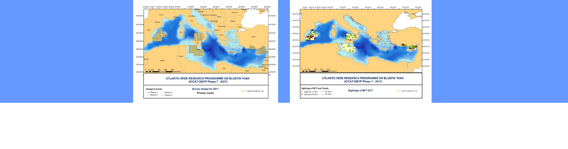
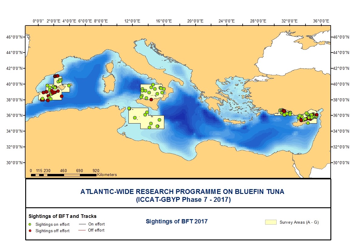 Sightings 2017
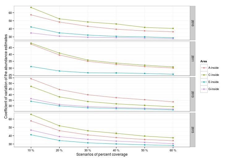 Scenarios
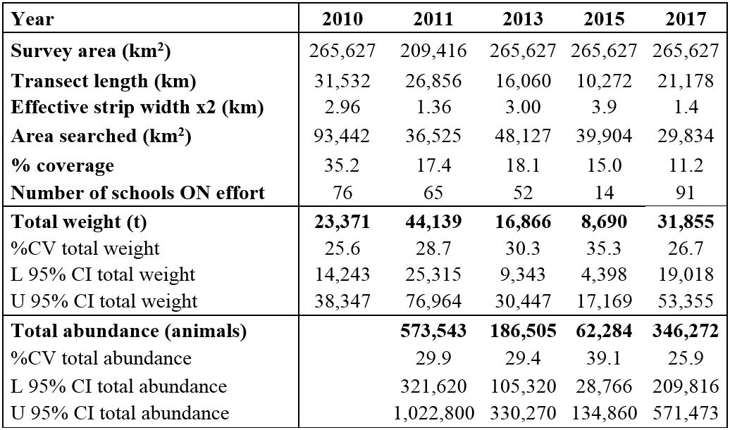 Table
Table